
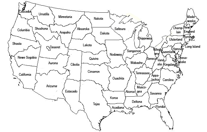
Introducing, Trumanverse 2.1. Border-wise, it is very similar to 2.0 (why is why it doesn’t get its own integer). All of the states have been named, finally, and some of the states have been renamed. The main relevant one is Dixona/Delosa, which is now Deltona. This should be the last of the name changes for that state. I had to come up with a name on the fly last time and was never fully satisfied with “Delosa” (the only state name without some historical roots or rationale).
Some state lines were moved, a state was folded into two others, Long Island and the Delaware Peninsula were formally given their boundaries and state names. Plymouth was split into two, as was suggested. Future changes are possible, but I’m feeling pretty good about this map. Unless I decide to utilize John Wesley Powell’s watershed map, I don’t expect it to change much going forward.
.jpg)
History:
Version 1.0
Version 2.0
I have been to all fifty states but I cannot decide that I have been to all of your states. I think it depends on how far north of SF I would have go to get to Shasta.
Also, Umatilla does not actually contain the city of Umatilla.
Correct About Umatilla, which is In Florida 🙂
Umatilla is also a city in Oregon
http://en.wikipedia.org/wiki/Umatilla,_Oregon